| Bankruptcy & Debt Information | Around ARIZONA Home |
 |
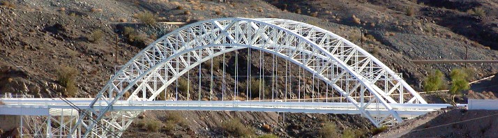 |
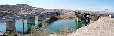
| The 1916 Trails Arch Bridge is still in use, but not for automobiles. 6-02 |
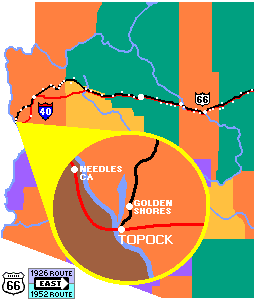
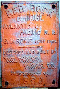
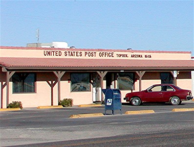
Where's Topock? Even if you look long and hard, you won't find Topock except on the map. In 1883, there was a little settlement along the area where the Colorado was narrow enough to make it feasible to the Atchison, Topeka and Santa Fe Railroad to build a bridge. A post office, first called Acme, and later changed to Topock, was established in 1906. Today, the Topock post office is located in Golden Shores. All that remains of Topock is a marina and a triad of bridges. The Red Rock Bridge crosses the Colorado. The first bridge to cross the Colorado River along the alignment of Route 66 was a wooden structure built by the railroad in 1883. They replaced the wooden bridge with the Red Rock Bridge in 1890. A daring and expensive project at the time, the bridge was one of the first steel bridges. For a construction cost of $462,434 ($9.4 million in 2003 dollars) Santa Fe's trains would pass over the longest cantilever bridge in America.
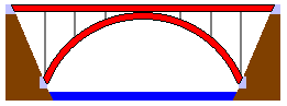
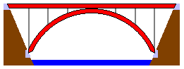
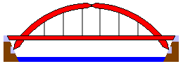
The Red Rock Bridge was designed to carry two 94 ton engines pulling 3,000 pounds per linear foot. Trains grew heavier and longer. The bridge was strengthened in 1901, but by 1911 the situation had become critical. A pier and support was added in the middle of the span and the bridge was no longer cantilever. Trains and cars share a bridge. The Needles Ferry began moving travelers across the Colorado in 1890. The National Old Trails Highway which followed the Santa Fe trail through Colorado, New Mexico and Arizona crossed the Colorado river via the Needles Ferry. In 1914, a flood took the ferry out of service. As an emergency measure, planks were put on the Red Rock Bridge and motorists crossed the bridge between trains. The Red Rock Bridge continued to carry motor vehicles until the Trails Arch Bridge was completed on February 20, 1916. The Trails Arch Bridge crosses the Colorado. The Trails Arch Bridge was located 800 feet downstream from the Red Rock Bridge, and like the Red Rock Bridge was a groundbreaking event in bridge building. For 12 years, it was the longest three hinged arch bridge in the nation. When Route 66 came into being in 1926, many parts of the National Old Trails Highway became part of the new route, and Route 66 crossed the Colorado over the Trails Arch Bridge.
Although it was a substantial improvement over a ferry and sharing a bridge with trains, the Trails Arch Bridge was not without its limitations. It was rated for a load limit of 11 tons, but was only wide enough for one way traffic of trucks and busses. This limitation was not a serious problem until the increase in truck traffic which came with World War II. Adding to the bridge's problems, the completion of Parker Dam on March 4, 1938, backed up water enough to cover the abutments and lower hinges of the bridge. Automobiles return to the Red Rock Bridge. The search for a new way for Route 66 to cross the Colorado began in the early 1940's. Sites north and south of Needles were considered, as was crossing over Davis Dam. It was finally determined that there already was a bridge more than adequate for all of the vehicles traveling on Route 66. The only drawback was that the Santa Fe railroad owned that bridge and was not inclined share right of way with vehicles again. This impediment was resolved when the Santa Fe opened a new bridge in 1945. The rails were removed from the bridge and 7 inches of reinforced concrete were poured for the roadway. The modification of the half century old bridge was completed on May 21, 1947, and automobiles again made their way over the Colorado on the Red Rock Bridge. It continued to carry Route 66's traffic for 19 more years.
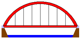
PG&E saves the Arch. When Route 66 abandoned the Trails Arch Bridge, its demise seemed eminent. In the ultimate act of recycling, Pacific Gas and Electric took over the bridge. They removed the roadway and replaced it with gas and utility lines. As the bridge approaches a century of use, its bright white paint gives it the pristine appearance of far younger structure. The Interstate spells the end for the Red Rock Bridge. In 1966, Interstate 40 came to the Colorado. A four lane steel girder bridge was placed on five concrete piers immediately south of the 1945 Santa Fe girder and truss bridge. Time had run out for the Red Rock Bridge. It was abandoned as was much of Route 66 with the coming of Interstate 40. It sat rusting and unused for over a decade until it was dismantled in 1978.
|
|
||||||||||||||||||||
|
|||||||||||||||||||||