| Bankruptcy & Debt Information | Around ARIZONA Home |
 |
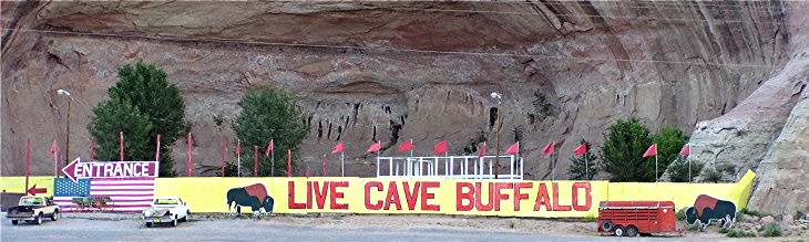 |
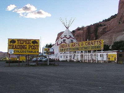
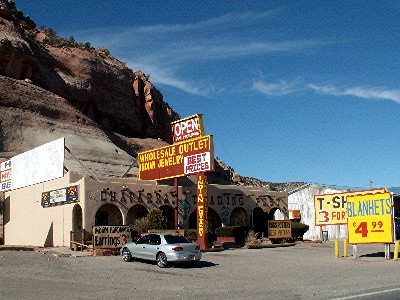
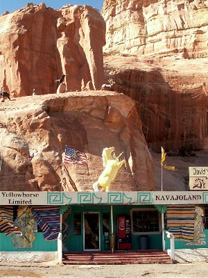
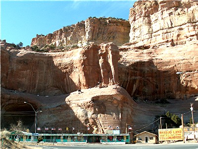
| At one time the Chief Yellowhorse Trading Post featured buffalo on the Arizona-New Mexico Border near Lupton. 9-03. |
Western cow town. The WPA Guide to 1930s Arizona lists the population of Lupton at 75, and describes the small community as "a western cow town, named for a pioneer." That pioneer is George William Lupton, but he has more of a connection with railroads than with cows. Mr. Lupton was the station master in Winslow in 1905, and later the Atchison, Topeka and Santa Fe superintendent in San Francisco. By 1929 he had become the assistant to the line's vice president in Chicago.
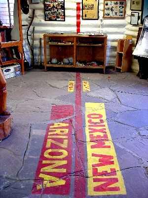
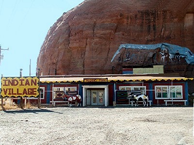
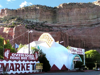
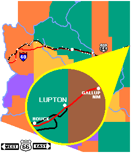
Fast forward. A decade or so after the WPA guide, Jack D. Rittenhouse listed the Lupton population at 33 in his 1946 edition of A Guide Book to Highway 66. There he described the community as a "post office; gas stations; store; no other facilities." The 2000 census lists 433 housing units in the Lupton Chapter of the Navajo Nation Reservation. The dot on the map makes Lupton looks like a community. As viewed from Route 66 or its present incarnation, Interstate 40, it's a collection of trading posts and a few other businesses. On the border. The Chief Yellowhorse Trading Post is the first enterprise past the Arizona-New Mexico border on Route 66. Actually, it's located right on the border. The state lines run through the store where one of Chief Yellowhorse's braves has painted a bright red line. One can only imagine the implications of such a location. Although both states are in the Mountain Time Zone, New Mexico observes Daylight Savings Time, but Arizona does not, so what time is it there anyway? New Mexico has a 5% sales tax and Arizona has a 5.6% sales tax, so do you pay sales tax based on the state in which the item was shelved, or in which the cash register is located? Is the owner's income taxed by New Mexico which has no state income tax, or by Arizona which does? We asked the proprietor how he handled these on-the-border problems. He informed us that they do not even apply. The trading post is located entirely in the Navajo Nation Reservation which extends from deep inside New Mexico to Highway 89 in Arizona. Route 66 and Interstate 40 pass through the reservation from just outside Gallup NM to just east of US 191 (the former Devil's Highway, Route 666). Businesses on the reservation collect neither Arizona nor New Mexico sales taxes. Instead, purchasers pay Navajo Nation sales tax of just 3%. The Navajo Nation is in the Mountain Time Zone and Daylight Saving Time is observed.
|
||||||||||||||||||||||||
|
|
||||||||||||||||||||||||
|
||||||||||||||||||||||||
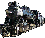 Railroad
settlements. Many of the settlements along Route 66 owe their
early existence to the railroad, since the highway runs parallel to the
tracks across most of the state. The tracks reached Lupton on May 1,
1861 as the Santa Fe owned Atlantic and Pacific Railroad beat Southern
Pacific to the Querino Canyon, blocking its access to northern Arizona.
Readers with a train fixation should visit our
Railroad
settlements. Many of the settlements along Route 66 owe their
early existence to the railroad, since the highway runs parallel to the
tracks across most of the state. The tracks reached Lupton on May 1,
1861 as the Santa Fe owned Atlantic and Pacific Railroad beat Southern
Pacific to the Querino Canyon, blocking its access to northern Arizona.
Readers with a train fixation should visit our